About Myanmar
Somewhere between India and Thailand
Myanmar - formally Burma - is still just a white speck on the world map for many. 30 years of isolation have protected the old, traditional ways of life and even today allow deep insight into ancient Southeast Asia. Daily life in Myanmar is still influenced by Buddhism, which is deeply rooted in society like nowhere else in Southeast Asia. Where monks go from house to house in their saffron red robes before sunrise to have their alms bowls filled. Where, broadly speaking, life continues to be played out on the streets and the cook shops steam from morning to evening. Where the vast majority of the female population paint their faces with a yellow paste (Thanaka), and many men still wear the Longyi (a sheet of cloth wrapped around the waist and legs), where right-hand drive vehicles drive on the right-hand side of the road and the rickshaw drivers are still addressed as ‘Master’ (“Saya” - customary address and title for teachers, doctors and every type of superior). Although Myanmar has witnessed significant development since the controversial elections of 10 November 2010, especially in the larger cities, it is in rural areas that traditions remain most intact.
")
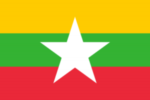 Key Facts

Capital: Nay Pyi Daw
President: U Win Myint
Currency: Burmese Kyat
Population: 54 million
Official language: Burmese
Main religion: Buddhist
History
Myanmar, formerly known as Burma, is known throughout the world as the Golden Country. It was one of the first places to be inhabited by mankind. It’s a place where you can enjoy once in a lifetime experiences.
The golden age of Myanmar dates back to the 11th century when King Anawrahta unified the entire country, creating the first Burmese Empire in Bagan - even before England was conquered by the Normans in 1066. The Bagan Empire covered the whole of the Menam Valley in Thailand and existed for approximately 250 years, before its downfall following an invasion orchestrated under the Mongolian leadership of Kubla Khan in the 13th century. The second Myanmar Empire was founded by King Bayinnaung in the mid-16th century. King Alaungpaya founded the third Myanmar Empire in 1752. At the height of the Konbaung Dynasty, Myanmar was colonised by the British.
Great Britain’s conquest of Burma lasted 62 years (1824-1886) and the country was integrated into its Indian Empire. Burma was governed as a province of India until 1937, when it became an independent, self-governing colony. The country gained its independence from the Commonwealth in 1948.
On 4 January 1948 at 4:20 a.m., the Union of Burma was established as a sovereign state under its first prime minister, U Nu. The democratic regime ended in 1962 with a coup d’État led by General Ne Win. Ne Win ruled for almost 26 years with a strict course of reforms. In 1990, the first free elections were held in almost 30 years, but the march held by the NLD party under the leadership of Aung San Suu Kyi was crushed by the military who did not want to relinquish power.
One of the key characters in Myanmar's 20th century history is the founder of the army and symbol of freedom, General Aung San, a student who became an activist, and his daughter Aung San Suu Kyi of the NLD, who received the Nobel Peace Prize in 1991. She is the world's most famous icon of peace, freedom and democracy, and is now living under house arrest. The third most prominent Burmese personality is U Thant, who held two terms in office as the UN Secretary General and enjoyed great admiration throughout the history of the United Nations.
In 2003, Myanmar underwent a change, which will perhaps be identified as a key event and the start of a process of democratisation. The military regime established a so-called ‘Roadmap to Democracy’. In principle, this triggered the next big step. The objective was to replace Myanmar's military leadership with a civilian government.
In November 2005, the military junta announced the relocation of the country's capital city from Yangon to the small town of Pyinmana, located approximately 300 km to the north . It was there, 3 km to the west, on a greenfield site 8-times the size of Berlin,that the new capital city of Naypyidaw (‘Royal Capital’) was established.
The constitution completed on 3 September 2007 was accepted by a vote held in May 2008 with over 90% of the votes, and was officially enacted in 2010. The new constitution continues to stipulate privileges for the military such as, for example, that a quarter of parliamentary mandates are to be given to members of the military.
In the parliamentary elections of 8 November 2015, the National League for Democracy/NLD won the absolute majority in both chambers of parliament, with 390 of the 664 seats in the first free election for 25 years. The ruling Union Solidarity and Development Party/USDP came in second place with 42 seats, followed by the Arakan National Party/ANP (22) and the Shan Nationalities League for Democracy/SNLD (15). The voter turnout was approximately 80%.
Geography
With a surface area of 676,578 km², Myanmar is, after Indonesia, the second biggest country in Southeast Asia and almost twice the size of Germany. The country has borders with the People's Republic of China, Laos and Thailand in the north and east, and with the Indian Ocean in the south. The Andaman Sea separates Myanmar from the south-western Indian islands of Andaman and Nicobar. To the west, Myanmar has borders with Bangladesh and the Indian states of Mizoram, Manipur, Nagaland and Arunachal Pradesh.
Geographically speaking, Myanmar can be divided into several zones. Located in the northern part of the country, are the Kachin Hills, with peaks over 3,000 m. It is here on the border with Tibet that the highest mountain in Southeast Asia is located, the Hkakabo Razi which stands at 5,881 metres. The Shan Highlands are located to the east of the country and reach heights of up to 2,500 metres. To the west, you can reach the Chin and Naga Hills via the Rakhine Yoma mountain range, with even steeper and higher peaks than the Shan State, such as the 3,053 m Mount Victoria. The fertile flat terrain of the Ayeyarwady basin lies between the Shan Highlands in the east and the mountain ranges in the west, which is 160 km wide and stretches from north to south over approximately 1,100 km. The Ayeyarwady is the longest river in Myanmar with a length of 2,170 km, forming a 47,000 km² large delta at its estuary where it enters the Indian Ocean in the south.
To the east of the Gulf of Martaban, the mountain range stretching south forms a watershed and acts as the natural border with Thailand. The Mergui Archipelago, with over 800 islands, forms a sunken mountain landscape off the coast.
Climate
As with other countries in South and Southeast Asia during the summer months, the wind blows from the southwest, drawing in the humid and hot monsoon from the Indian Ocean. A wreath of mountains which encircles the central Myanmar plateau protects the country against torrential downfall, which other areas of this region have to endure.
In the south of the country, the monsoon rains can drive into lower Myanmar unimpeded. Annual precipitation therefore reaches 1,500 to 2,500 mm.
On the coasts of Rakhine (Arakan) and Tanintharyi (Tenasserim), behind which the monsoon clouds remain over the mountains, the level of precipitation can even reach 5,000 mm every year. Things are different on the leeward side of the mountains; here there is a maximum of 2,000 mm of rainfall each year. The dry region of central Myanmar receives just half of this. The 2,000 m high Rakhine (Arakan) Yoma mountain range sees the least amount of rainfall in Southeast Asia.
The best time to travel there is from November to March. During this time, the weather is like that of a pleasant European summer. However, temperatures in some mountain regions can drop to 0°C. Jackets, jumpers, socks and warm pyjamas are necessary during this time.
Travelling during the months of April and May should best be avoided. During these months temperatures easily climb to over 40°C, even in Yangon.
The rainy season lasts from May to October. Even though, during this time of year, the majority of beach hotels are closed, river cruise ships between Mandalay and Bagan are rare, balloon trips no longer take place and pilgrims no longer hike to the Kyaikhtiyo Pagoda (Golden Rock), we still warmly recommend this time of year. Temperatures during the day are between a comfortable 25°C and 30°C, the landscape is rich in tones of green and it really is wonderful to travel when there are fewer tourists on the move.
Flora und Fauna
Over 50% of Myanmar's surface area is forested. Evergreen rain forests cover large parts of the mountain ranges and the rest of the country, and, in addition to teak trees, it is mostly bamboo that grows here. In the Shan Highlands to the east of the country and in the north it is predominantly pine and oak that grows. The Ayeyarwady Basin in the central region of the country is home to tropical dry forest and xeric shrublands.
The dense forests provide suitable living space for numerous species of animal, whereby some of them are considered to be under threat of extinction (for example, the large-spotted civet). Larger mammals found here include the panther, bears, wild water buffalo, rhinoceros and different species of primate such as, for example, the capped langur and the pig-tailed macaque. The red panda, linsang and tapir (Asian tapir) can also be found. The mangrove regions along the coast are home to numerous crocodile.
Asian elephants can be seen the whole year round in one of the numerous camps in the Bago Yoma mountain range, or in the north, near the village of Kathar. A visit to the Green Hill Valley Elephant Camp is also recommended, approximately 45 minutes’ drive from Kalaw.
Between the months of October and May, to the north of Mingun and near to Sein Pankhone, with a little bit of luck you will be able to see how Irrawaddy dolphins work together with the fishermen while they make the catch.
Population
Myanmar is a multi-ethnic state with approximately 55 million inhabitants, who belong to 135 different ethnic groups. The largest ethnic group, representing 70% of the population, is the Bamar. The Shan is the second largest ethnic group (8.5%). This group resides predominantly in the country’s Shan State, in regions approximately 1,000 m above sea level.
The predominantly Christian Kayin State represents 6.2%, and the Mon State 2.4%. The Padaung belong to the Mon-Khmer language group and are comprised of around 150,000 people. They live in the southern Kachin and Shan States. 2.2% are Chin and 1.4% Kachin.
Approximately 730,000 Rakhine people live in the Rakhine State. Other sources even put their percentage of the entire population at 4%. The Rakhine State is also home to the Rohingya, whose status as an ethnic group has been refused, and are referred to by the government as ‘Bengali Muslims’. Many of them have fled to Bangladesh. Furthermore, Chinese nationals make up 1 to 2% and Indian nationals 1% of the population.
Approximately 89% of the population are Buddhist (above all the Bamar). The Kayin State is home to a significant Christian minority. In addition, approximately 4% of Muslims in the country belong to Rakhine, while those residing in the northern mountainous regions are predominantly followers of natural religions.
The individual ethnic groups speak their own languages. The official language is Burmese. English is important as a language for trade and commerce. In comparison to other developing countries, the estimated literacy rate is high, at 85%. The numerous Buddhist monastery schools enable the followers of this religion to have a basic education.
The previously well-equipped healthcare system is now woefully insufficient, especially in the rural regions, because of the long-running civil war in Myanmar: many children are malnourished, infant mortality stands at 7%, and the average life expectancy is 62 years. For these reasons, the population is only growing at a rate of 0.9% per year.
Political System
The new constitution of 2008 established a parliamentary democracy, heavily influenced by military control. The president (Thein Sein since March 2011) is the head of state and government, and is elected by parliament every five years.
Parliament is divided into the Chamber of Nationalities (Upper House [Amyotha Hluttaw]) and the Chamber of Deputies (Lower House [Pyithu Hluttaw]). The Chamber of Nationalities has 224 members (169 elected members, 56 appointed military personnel) and the Chamber of Deputies has 440 members (330 elected members, 110 appointed military personnel). Both houses of parliament are elected for a period of five years.
Myanmar is subdivided into seven union states (pyi ne-myar) and a further seven provinces (taing-myar).
Economy
Up to the early 1960s, Myanmar was one of the wealthiest Asian countries. But the economy suffered a severe collapse due to the introduction of a socialist, centrally planned economy. In the late 1980s, initial measures were taken to move to a free-market economy such as, for example, the reprivatisation of state-run businesses. Since 2011, the government has initiated wide-reaching economic reforms.
Annual income per capita only stands at around US$ 900. The reasons for this are a cumbersome and corrupt government apparatus and an ageing infrastructure. The Myanmar economy is also weakened by a well-established black market for drugs, precious wood and gemstones.
The major economic sector is, as before, agriculture, which generates 35% of gross domestic product. Many businesses are organised as cooperatives. In order to cover the nutritional needs of the population, rice, sugar cane, dry pulses and millet are mostly cultivated. In addition to rice as an important export product (until 1945, Burma was the world's largest exporter of rice), peanuts, jute and cotton are also cultivated for export. Poppies are also cultivated in Myanmar, the base product for opium and heroin. The main region is the so-called Golden Triangle, in the border region of Laos and Thailand. The export of teak wood is also important to the forest industry. Cattle breeding is almost insignificant due to the country's predominant faith (Buddhism).
Myanmar is a country rich in natural resources (ores and crude oil, lead and zinc, precious gems such as sapphire, ruby and jade). However, to date only a small proportion of the natural resources has been utilised. Large natural gas reserves are the most important source of economic growth. In the country’s weak industrial sector, approximately 10% of the working population are employed. The food and textile industries are dominant. The city of Yangon (Rangoon) is also home to the chemical and petrochemical industry. Revenues from the tourism industry are increasing, but continue to play a subordinate role.
The Asiatic free-trade zone (Asean Free Trade Area, AFTA), founded in 1994, includes all 10 member states of the ASEAN (Association of South-East Asian Nations) and therefore also Myanmar. The ASEAN Free Trade Agreement came into force in 2002. Exports (natural gas, clothing, wood products, fish and rice) are delivered to Thailand, India and China. The necessary machinery, consumer goods, vehicles, construction materials and foodstuffs are sourced from China, Singapore and Thailand.
Do you have any questions?
Feel free to contact us. Our team will be happy to help you.