Naypyidaw is the new national capital of Myanmar, located in Kyatpyae Village of Pyinmana Township of Mandalay Division. Naypyidaw means "Royal City". The administrative capital of Myanmar...
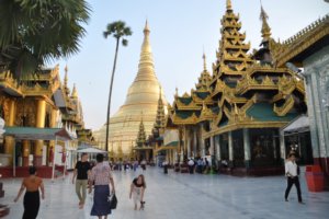
Yangon, the capital city, is the main gateway to Myanmar. Evergreen and cool with lush tropical trees, shady parks and beautiful lakes. Yangon has earned the name of "The Garden City of the East".
The capital of Myanmar Last Kingdom and of Myanmar Kings, is situated in Central Myanmar 668 km north of Yangon. It was founded by King Mindon in 1857 and remained to be the official seat of Myanmar Kings...
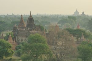
Known as the city of four million pagodas, is one of the richest archaeological sites in Asia and the main tourist destination in Myanmar. It was also capital of the First Myanmar Empire.
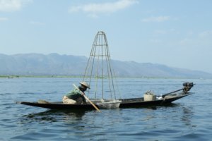
Inle Lake, natural and unpolluted, is famous for its scenic beauty and the unique leg-rowing of the Inthas, the native lake-dwellers. Moreover, floating villages, colorful daily floating market...
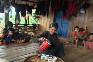
Kyaing Tong is known for its scenic beauty and many colorful ethnic tribes. Situated in the eastern Shan State and 452 km from Taunggyi and 176 km from Tachileik.
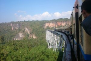
A journey along the legendary ‘Old Burma Road’ from Lashio to Mandalay. You will wander around the colourful market in Lashio, visit the ancient Shan Palace in Hsipaw and take a train across the spectacular...
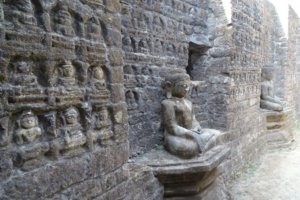
Rakhine, once known as Arakan, lies on the long and narrow western coast of Myanmar, divided by high mountain ranges from the mainland called Rakhine Yoma. This long and narrow state with many islands…
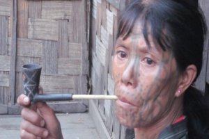
Chin State is located at the western part of Myanmar bordering with India. Mountainous region, which hills are higher and slop more the Shan hills. Chin is one of the National races of Myanmar.
Extreme N Myanmar. It is a mountainous region bounded on the NW by India and on the N and E by China and traversed by tributaries of the Ayeyarwady River. Myitkyina, the capital, and Bhamo are the chief towns.
Kayah State, formerly Karenni State, is bordered by the Shan Mountains to the north, Thailand's Mae Hong Son province to the east and Kayin (Karen) State to the south. It is the smallest of Myanmar’s seven states.
Is on elongated area lying to the south-east running from the north-west to the south-east. The total area of the State is 11,731 square miles. Besides Kayins who are the majority, the Mons, Myanmars...
Mon State stands along the upper part of the Tanintharyi coastal strip. The total area is 4,747 square miles. There are islands, hills, equatorial forests, crop land and plantations. Mawlamyine, the third largest city in....
Covers the delta area. It has over four million acres of cultivated fields. The chief crops are paddy and jute. Pathein is the capital which is the fifth largest city and the seaport on Ngawun River. Ayeyarwady Division...
Bago Division is the second biggest producer of paddy after Ayeyarwaddy division. It is bordered by Magway Division and Mandalay Division to the north; Kayin State, Mon State and the Gulf of Martaban to the...
Is sharing the border with Indian and Kalay-Tamu border trade cities along the India-Myanmar border. Kalay-TaMu road in Myanmar and Imphal main road in India played a vital role at the time of the World famous Imphal...
Adjacent to Mon State to the north and Thailand to the east. Taninthayi Division occupies a long narrow coastal plain bounded by the Andaman Sea in the east, which runs to...


